
By Juanpablo Ramirez-Franco, WBEZ
This coverage is made possible through a partnership between WBEZ and Grist, a nonprofit, independent media organization dedicated to telling stories of climate solutions and a just future. Sign up for WBEZ newsletters to get local news you can trust.
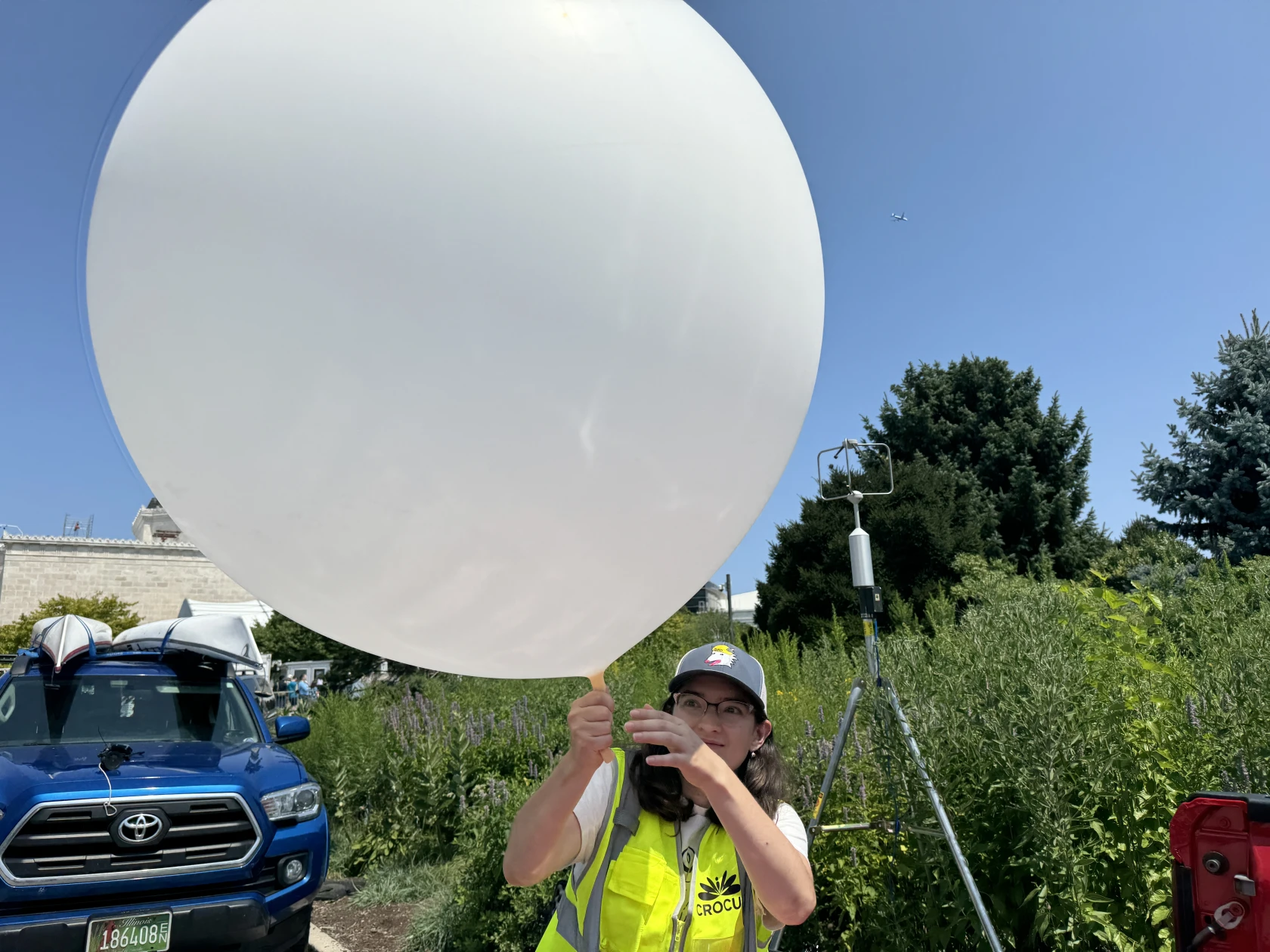
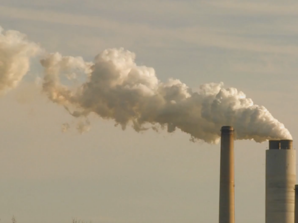
On a hot July day, a team of scientists led by Argonne National Laboratory launched scores of weather balloons from four different Chicago locations, hoping they’d make it up to 12 miles above the city. Their goal? To track how hot air rises over the city so we can better predict how climate change-driven heat will impact different neighborhoods in the future.
Scott Collis, an atmospheric scientist at Argonne National Laboratory in suburban Lemont, predicted that the information would be “a groundbreaking, world first data set,” effectively providing scientists and policymakers with unprecedented, granular information.
Until now, scientists haven’t had a substantial, vertical profile of Chicago’s atmosphere. The closest sites collecting similar data via weather balloons are in Lincoln, Ill. and Davenport, Iowa. As a result, there’s effectively no data about how Chicago’s atmosphere responds to its massive cityscape and proximity to Lake Michigan.
The research in Chicago is part of a federal study led by the U.S. Department of Energy’s Community Research on Climate and Urban Science (CROCUS) examining how the topography of various neighborhoods — which includes the size of buildings, the amount of paved surfaces and the density of the tree canopy — can affect how hot it feels on the ground. This is called the “urban heat island effect.” To piece it together, scientists need to better understand how high the heat captured in the ground rises into the atmosphere and what it does when it gets there.
“How temperatures change with height, how that cooling effect of the lake breeze moves across [Chicago] is intrinsically linked not just to the temperatures at the surface, but the temperatures above us as well,” Collis said. “That’s why it’s really vital that we measure how the temperature changes with height.”
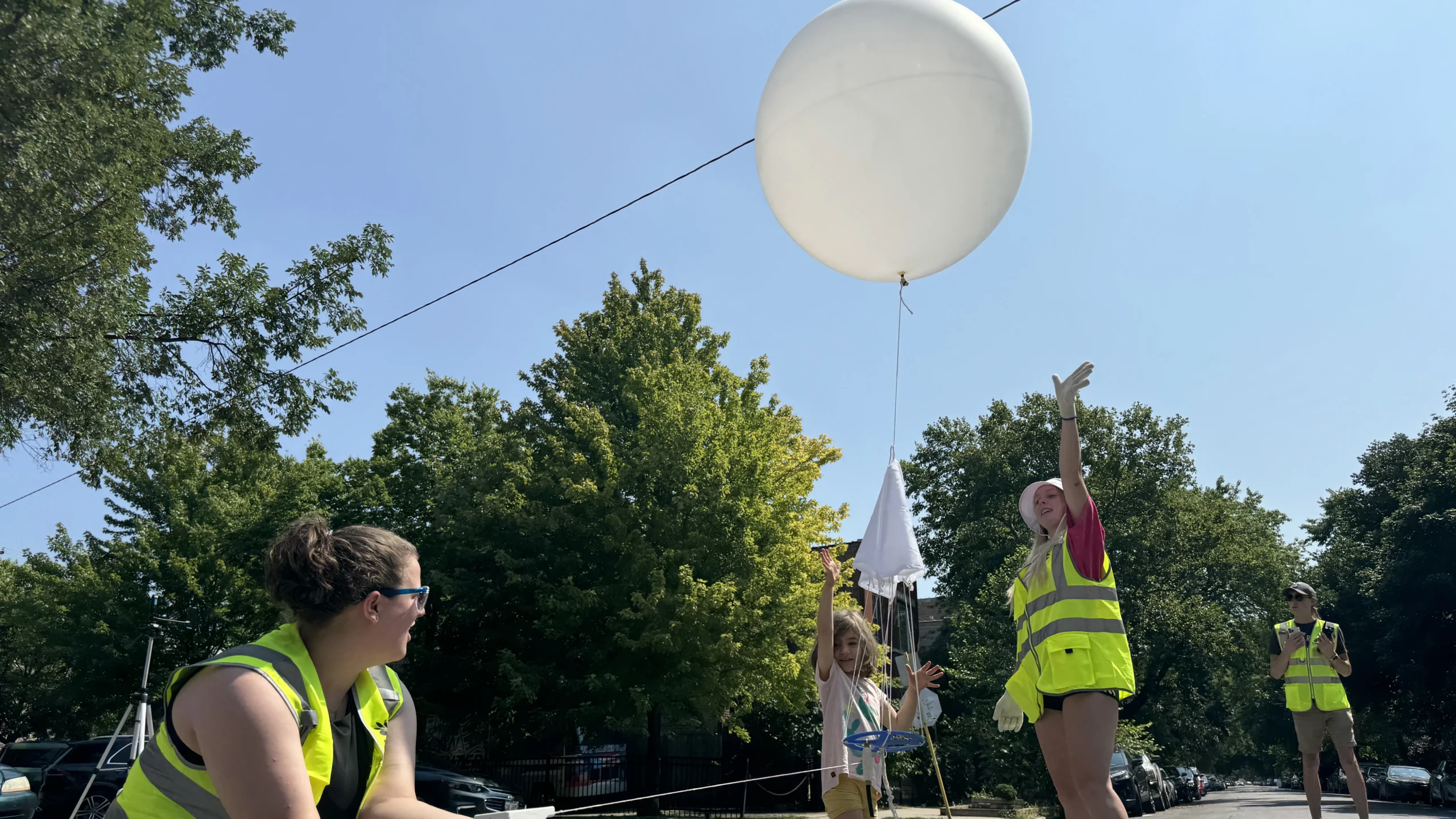
The weather balloons were launched from lakefront and points on the West and South sides. Juanpablo Ramirez Franco/WBEZ
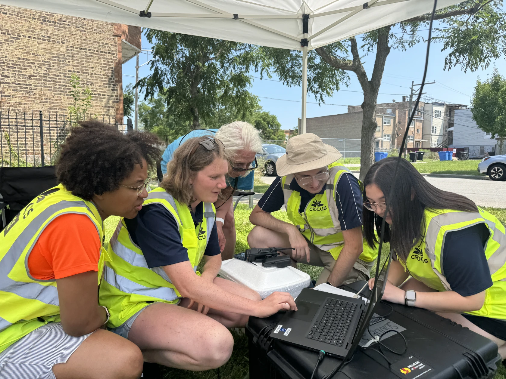
During the two-week study period, student-volunteers scattered across the city to collect temperature readings at ground level while scientists installed five different long-term, high-quality weather sensors.
The centerpiece was the more than 40 weather balloons released across the city’s skies, launched from four different sites to gauge how the heat varies: Humboldt Park on the West Side, the Shedd Aquarium, Greater Grand Crossing and West Woodlawn on the South Side. Every five feet or so, a radio transmitter attached by a string recorded measurements like temperature, moisture, air pressure and the location of the balloon, beaming the results back down to earth.
The hope: This data will provide local communities and officials with insights into how to build a more climate-resilient city. That’s important because extreme heat isn’t going anywhere, and increasingly it’s the norm. The European Union’s Copernicus Climate Change Service documented the hottest day on Earth in recorded history on July 22.
Max Grover, an atmospheric data scientist at Argonne, said it would be many months before the collected data sets will be fully analyzed. But scientists already know the uneven distribution of heat across the city tends to be felt disproportionately in traditionally under-resourced communities. That’s due in large part to the city’s history of racial segregation and redlining.
The weather balloon research will give scientists a substantial, vertical profile of Chicago’s atmosphere for the first time. Juanpablo Ramirez Franco/WBEZ
A recent analysis from Columbia University’s Brown Institute for Media Innovation found that over 80% of historically redlined areas are more likely to suffer extreme summer temperatures than non-redlined areas, where discriminatory lending practices effectively kneecapped urban renewal projects. That’s translated into fewer trees and more impervious surfaces like asphalt and concrete — a recipe for locking heat into the ground.
Trees and tree canopies are among the most effective strategies to mitigate urban heat islands as they absorb the sun’s rays, provide shade and release vapor from their leaves in the evening, which cools the surrounding environment.
Back in Humboldt Park, Ralph Cintron, a professor of Latin American studies at the University of Illinois Chicago, said that even within Humboldt Park, there’s a massive development gap between the east side of the neighborhood compared to the west.
“There’s a big difference in terms of gentrification, in terms of property values, in terms of ethnicities,” said Cintron. Importantly, he adds, there’s also major differences in tree coverage, which he said is contributing to hotter conditions on the heavily-paved west side of the Puerto Rican enclave.
Neighborhoods including Humboldt Park and West Woodlawn continue to lack significant tree canopies. A report from Morton Arboretum’s Chicago Region Tree Initiative ranked both neighborhoods as high priority areas in need of more trees.
Scientists are counting on the tens of thousands of recently collected data points to strengthen their modeling capacity — not just to better understand the urban heat islands throughout the city, but also the effects of the lake breeze and how the towering buildings downtown interact with it to shape Chicago’s climate.
“The climate simulations we’ve got right now, they just don’t cut it.” said Collis. “So we’re busy making the next generation of climate simulations that will allow communities to make data-driven decisions.”
Catch more news at Great Lakes Now:
Major federal funding aims to speed transition to clean energy in the rural Midwest
South Shore residents are fed up with garbage on their streets
Featured image: Volunteers launched weather balloon from four different Chicago locations to track how hot air rises over city neighborhoods as part of a U.S. Department of Energy study. Juanpablo Ramirez Franco/WBEZ