By Terri Cook, Eos

This story originally appeared in Eos and is republished here as part of Covering Climate Now, a global journalism collaboration strengthening coverage of the climate story.
During the mid-1930s, in the wake of devastating Dust Bowl–era storms, the U.S. Department of Agriculture (USDA) established a series of experimental watersheds to better understand how erosion, runoff, and water quality vary in response to different agricultural practices. In the 1950s, USDA expanded this program to create the Agricultural Research Service (ARS) Experimental Watershed Network.
More than a half century’s worth of high-resolution observations from within this network have led to unprecedented understanding of watershed processes. As Goodrich et al. highlight, long-term knowledge gained from the ARS network now underpins dozens of models and research methods that guide billions of dollars’ worth of conservation measures and infrastructure investments.
The network’s objectives initially focused on quantifying effects of soil conservation practices and collecting data to guide the design of water conservation structures. In the 1970s, following passage of the Clean Water Act, this scope expanded to include water quality issues. As climate change issues grew in importance, some network sites also began monitoring water–energy–carbon fluxes and collecting long-term, high-frequency hydrometeorological measurements.
The data collected within the ARS Experimental Watershed Network are noteworthy for the long time period they cover and their impressive reach. More than 10,000 peer-reviewed publications have been based on data collected in the hundreds of watersheds that at various times have been included in this network.
The authors provide numerous examples of how scientific insights gleaned from this network have yielded societal benefits, such as in the calibration and validation of remotely sensed data to improve soil moisture monitoring, which has enhanced drought analysis and flood forecasting and helped in the development of a satellite evapotranspiration mapping tool kit. This tool kit provides timely information about crop water use at scales ranging from individual fields to entire continents, and it informs U.S. Drought Monitor reports and international crop monitoring.
Additional applications based on data from the network have guided the designs of flood reduction, bank stabilization, and water conservation projects. Still others, such as a water erosion model, have saved U.S. taxpayers billions of dollars, the authors report.
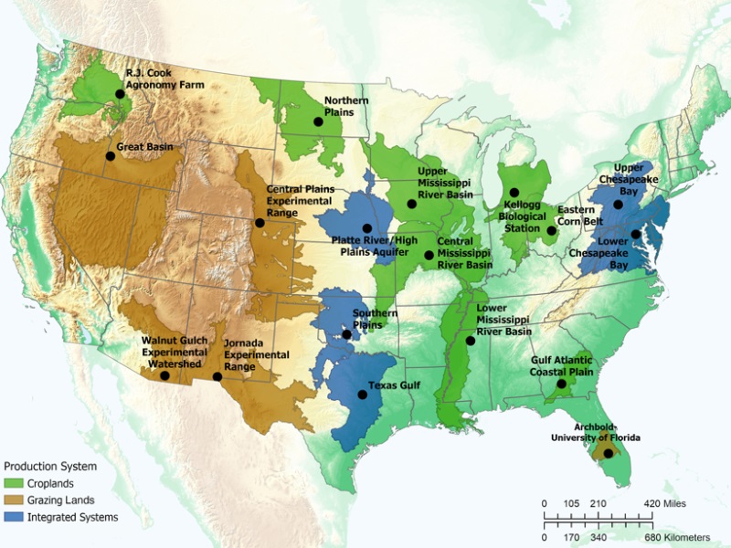
Of the more than 600 watersheds ARS has managed, 120 remain today as active research sites. About 10 of the ARS experimental watershed labs form the core of USDA’s recently established Long-Term Agroecosystem Research network, which the authors say will help ensure the continuity of one of the most important sources of data informing the development and validation of watershed models and land management methods. (Water Resources Research, https://doi.org/10.1029/2019WR026473, 2021)
Catch more news on research on Great Lakes Now:
European Colonists Dramatically Increased North American Erosion Rates
PFAS is in fish and wildlife. Researchers prowl Michigan for clues.
Road Salt: Researchers look at vegetables and juices for alternatives to salt
Water could make the Great Lakes a climate refuge. Are we prepared?
U.S., Canadian researchers conduct binational birds conservation research
API key not valid. Please pass a valid API key.Featured image: The recently established Long-Term Agroecosystem Research network, which consists of sites shown on this map, will continue more than 60 years of research conducted at USDA’s Agricultural Research Service watershed study sites. (Image Credit: USDA)


